If you’ve just looked out of your window and seen it bucketing down, or a co-worker’s walked into the office looking like they’ve taken a swim fully clothed, get your brolly ready: that rain’s not going to stop.
This afternoon’s downpour started due to “a lot of moist air we’ve seen come down from Queensland and New South Wales, culminating in a lot of storms through the Melbourne area and all of Victoria,” says Stephen King, the Bureau of Meteorology’s senior forecaster.
King says that Melbourne’s average rainfall in March is around 50 millimetres. “We’ve already seen about 20 millimetres today, so we get a few more downpours overnight we could meet that monthly average.”
We think you might like Access. For $12 a month, join our membership program to stay in the know.
SIGN UPThe deluge that occurred just after 2pm today is only the first wave, with more storms to come throughout the afternoon, King says. Another heavy downpour is predicted between 5 and 6pm. In other words, when most of us will be heading home.
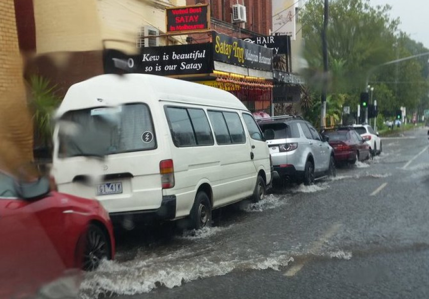
“These storms could easily produce 10 to 30 millimetres and possibly more, even 50 to 60 millimetres, so we are quite concerned about flash flooding in the Melbourne area this afternoon,” says King.
The State Emergency Service has advised people not to drive, ride or walk through flood waters, and to stay away from storm drains and creeks.
Starting tomorrow, the system will move to Eastern Victoria, with fine and mild conditions set to return by Thursday and Friday.
This could be the turning point in Melbourne’s Indian summer, which has seen unseasonably warm autumn conditions.
“We should have a strong cold front come through early next week which should bring us back to normal March conditions,” says King.
The storms began in northeast Victoria last night, with Yea’s main street flooding after the town received 45 millimetres of rain in 24 hours. Nearby Strath Creek, just 90 minutes north of Melbourne, recorded 63 millimetres of rain in half an hour.