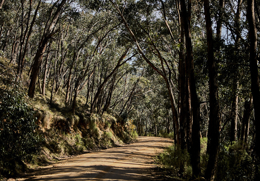
The flow of the Yarra River effortlessly weaves nature into Melbourne’s landscape, but beyond the city’s sprawling parks, walking tracks and cycleways, there are ancient geological formations, underrated beaches and lush rainforest to explore. We’ve rounded up some of the best day walks (many with a swim tied in) within a short drive from Melbourne so you can get your nature fix without too much hassle.
Lerderderg Gorge Walk – 8 kilometres return
Just over an hour north-west of the city is this tranquil state park suitable for mountain-bike riding, four-wheel driving or simply hanging by the cool shallows of the Lerderderg River. If you really want to slow it down you can camp overnight under the eucalypts, but for daytrippers the Lerderderg Gorge Walk is a moderately difficult 8-kilometre loop that follows the river from O’Brien’s Crossing picnic area and through pretty Aussie bushland. The sheer gorge reveals ancient rock formations and glacial sediment, and stopping for a swim in the freshwater stream is a must. For the more adventurous, the track also links a multi-day, 89-kilometre walking track from Bacchus Marsh to Daylesford.
Bushrangers Bay and Cape Schanck – 13 kilometres return
The unparalleled rugged coastal scenery of Cape Schanck is worthy of a detour from the Mornington Peninsula’s popular bayside towns of Sorrento and Portsea. Start this walk at Boneo Road car park, 100-kilometres south of the CBD, and the sandy trail will take you through banksia groves and past basalt cliffs, mossy rocks, swirling deep-blue water and, as you reach the treacherous Cape Schanck, crashing waves. Time your visit for a low-tide swim at the halfway point at one of Victoria’s most beautiful natural pools, Bushrangers Bay, but be wary, the tides and weather can change quickly so check Beach Safe before your visit.
We think you might like Access. For $12 a month, join our membership program to stay in the know.
SIGN UPWerribee Gorge Circuit – 10 kilometre circuit
Werribee Gorge, traditionally owned by the Wadawurrung and Wurundjeri peoples, is a native-Australian haven among predominantly farmland. Depending on your enthusiasm, the gorge can be explored at various lengths (there’s three-, four- and five-kilometre options), though the 10-kilometre loop takes in its full grandeur and offers outstanding views of the gorge’s enticing river from a rocky ridge. Start at the lower carpark and do the track anti-clockwise, so you get the hard part done first, and then can meander along the river on your way back. A wetter spring this year means it’s topped up and ready to jump in. Keep an eye out for wildlife – wedge-tailed eagles and peregrine falcons soar above, or you might even spot an echidna. To avoid the crowds opt for a weekday walk, and pack plenty of water. This track is about an hour north-west from the city.
Cathedral Range Southern Loop – 10.5-kilometre circuit
An early start is needed to conquer this longer, more challenging hike. The Cathedral Ranges are two hours north-east of Melbourne and offer steep sandstone rocky peaks and expansive views over the valley below. Experienced hikers can take on the Cathedral Range Southern Loop from the Sugarloaf Saddle Carpark and follow a steep ascent to Sugarloaf Peak, where alpine ash and snow gums line the terrain. Some rock scrambling is required, and the path is tricky to find, but the 360-degree views at the top of Sugarloaf Peak make this exceptionally rewarding. The final ascent up Razorback ridgeline is aptly named – take your time here before finding respite in the rainforest near Jawbone Creek. For a cruisier walk through the Cathedral Ranges, try the Friends Nature Trail or Little River Walk.
Please note that the Cathedral Range Southern Loop is suited to experienced hikers as it is known to be a challenging hike. There have been multiple emergency rescues in the area. Always be cautious and obey all safety signs and warnings.
Point Addis to Anglesea – 7.3 kilometres one way
Anglesea is a good distance away from Melbourne to feel like you’re on holiday, even for a day. It also marks the midway point of the Surf Coast Walk, a 44-kilometre beach pilgrimage from Torquay to Airey’s Inlet. A standout section starts at Point Addis (about 90 minutes from the city), a protected marine area with abundant rock pools and limestone reefs. This part of the coast, of integral significance to the Wathaurong people, crosses scrubby heathland, rugged sandstone cliffs and white sand beaches. After descending the Anglesea cliffs to the town, you could continue another three kilometres up the bluff to Point Roadknight to gaze back across the coast and Anglesea River, or stop to grab some fish’n’chips from Fish by Moonlite before heading home.
To stay safe, make sure you follow safety rules as set out by Parks Victoria. Find details here. And make sure you pack lots of water.
This article was originally published on November 27, 2020. It was updated on December 8, 2023 to reflect new information and remove out-of-date links.


